It’s one of the United Kingdom’s most scenic long-distance hikes, you can tackle it in a week or less, and it has good infrastructure, so it’s no wonder around 120,000 people use the West Highland Way route annually and 36,000 people walk the whole trail. It’s officially 96 miles from start to finish, although I tell everyone it’s 100.
It was established in 1980 and in Scottish Gaelic it’s Slighe Na Gàidhealtachd An Iar but I had enough trouble pronouncing the name of the town where the trailhead starts! You may be familiar with some of the landscapes from seeing epic films like Braveheart and Rob Roy and you will certainly see some of the best of Scotland’s magnificent scenery. Definitely keep your eyes peeled for wildlife and you may catch glimpses of grouse, deer, squirrels, goats, ospreys and even golden eagles. You will gain a total of 3,000m (10,000ft) in elevation across the whole trail.
I am an experienced hiker and walked the West Highland Way solo but of course you can do it with friends or even join an organised tour.

Table of Contents
When to hike the West Highland Way
I did the West Highland Way route in the Spring (late April) and had surprisingly good weather, with only one morning of rain. The landscape is a patchwork of dull green and bright brown from the dead bracken, enlivened by brilliant golden gorse flowers, and there are bluebells and other spring wildflowers amongst the fresh green foliage of the woodlands.

Britain’s temperate climate means that you can hike the WHW all year around, although a winter hike would probably be a very different experience and would take some extra packing but with the potential bonus of snow-covered mountains.
The summer months are obviously popular but I chose to avoid these because I’m not a fan of Scotland’s famous “wee pests”, those clouds of annoying midgies that descend on hikers and campers. I think September and October would also be good times to walk. The purple heather carpets the hillsides from late August and deciduous trees turn warm colours.
Planning and preparing for the West Highland Way
The walk is generally tacked from south to north and there are good reasons for this, which you’ll see if you take a look at the West Highland Way map. Starting from Glasgow allows your walking muscles to more gradually, which eases you in with more gentle sections before the more demanding northern stages.

Apart from the direction of travel, there are many ways to skin this cat, in terms of how many days it takes to hike and what West Highland Way accommodation you choose to stay in along the way.
You can be completely independent and camp, or stay in youth hostels and budget West Highland Way accommodation, or there are comfy B&Bs and even nice hotels – the choice is yours. It’s nice to think you’re supporting local businesses on your trip. I would recommend booking Wet Highland Way accommodation ahead as it is limited and was fairly full even in April, which is outside the peak summer season.
I would say 7 days is ideal but for me hiking the West Highland Way 6 days was enough as long as you are prepared to put in a couple of big (20+ mile) days. That was mainly because accommodation was booked up at crucial points so I had to rejig my itinerary to fit. Which just shows how flexible the trail can be. Some people hike the West Highland Way in 5 days, heck some people even run it in less than 24 hours. You don’t have to worry about accommodation then!

Definitely spend the months before you hit the trail doing some training. The West Highland Way route is not technically demanding and the paths are good but can be hard underfoot at times so make sure you are used to walking in your hiking boots, including on rough, stony paths. I’ll admit I did not do any hardcore training before my trip but hiking up and down steep hills is important and I upped my yoga game to improve my core and leg strength, as well as balance. I did a couple of big walking days to test my endurance.
I’ve written a separate post on packing for the West Highland Way here.
Stage 1: Milnagavie to Drynnan
Ignore what it looks like, Milnagavie is pronounced “Muln-guy” or that is the closest approximation I could get to it (and I kept forgetting). Milnagavie is a village on the outskirts of Glasgow and I got a taxi from Glasgow airport directly there. A lovely big sign in the centre of town is perfect for a photo opportunity and then you are walking through country parkland. Dog walkers and elderly people are common on a weekday and I felt quite excited to leave them behind as I embarked on a “proper walk”.

The landscape gradually changes to plantation and farmland. The best stop on the way is the Glengoyne distillery, where you can taste a dram of whisky before heading onwards. There’s a pop up café on the trail near here for a snack and a drink if needed.
I was definitely taking my time on day one but it still only took me four hours (11am to 3pm) to walk this first stage of the West Highland Way. The terrain is gentle, the track good, and overall it’s an excellent warm up day if not terribly interesting scenery.

In the pretty village of Drynnan I stayed at the delightful Kip in the Kirk, an actual old church that has bunkrooms with good bathrooms, a cosy living room, and Frances serves up honestly the best scones I have ever eaten for late afternoon tea.
There are three pubs in the village serving up hearty pub meals. There is also a small shop for provisions, which opens early and closes late to cater for walkers. I got picnic supplies for the next few days because there is nothing until Crianlarrich.
Stage 2: Drynnan to Rowardennan
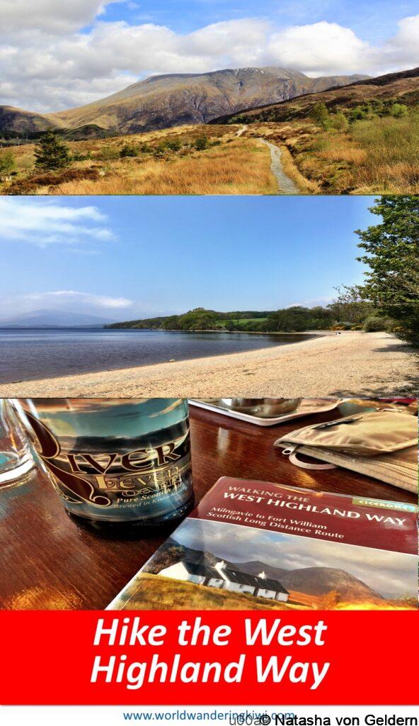
This part of the trail is through the Loch Lomond & Trossachs National Park and the morning is spent approaching and walking over Conic Hill. The views of Loch Lomond are spectacular from here although I didn’t linger because it was very windy. The good thing about the wind was that it blew all the clouds away, leaving a limpidly blue afternoon spent walking along the lake shore of Loch Lomond.

There’s a good café and a pub at Balmaha – where you come down from Conic Hill – if you fancy a coffee pick-me-up or don’t have a picnic lunch. I enjoyed my lunch on the beach – absolutely beautiful.

There’s also a statue of local legend Tom Weir in the lochside gardens at Balmaha – a lovely tribute to a famous Scottish climber, writer and TV presenter.

The last portion of the day is through plantation woodland to Rowardennan. There’s a rather lovely looking hotel here but I pressed on 15 minutes to the youth hostel and it was worth it because the hostel is a gorgeous old hunting lodge just above the lakeshore. The views from the lounge while I rehydrated were lovely. The hostel puts on a good two-course dinner for £12. This stage builds nicely in terms of effort and rewarding scenery.

Stage 3: Rowardennan to Crianlarich
This was a long day for me – I left Rowardennan at 8.30am and didn’t get to the Crianlarich Youth Hostel until 6.30pm (did I mention I’m quite a slow walker). It starts with beautiful lakeside walking. It was nice to leave the plantation forest behind and see natural oak forest filled with lemon primroses, bluebells and violets.

The section of trail between the Inversnaid Hotel and Inveroan is slow going because of the boulders and tree roots but the path is not otherwise difficult. I stopped for a cream tea at the Inversnaid hotel, keeping apart from the less smelly guests on the terrace. It’s a long day of up and down walking. Hiking almost the whole length of Loch Lomond really gives you an idea of how big it is.
After awhile, leave the lake behind and turn inland through moss-carpeted conifer forest. Look out for ruined crofts and long-coated black goats with impressive curling horns before the trail climbs up through rugged farmland towards Doune Byre, an old shepherd’s hut that is now a bothy. Coal-faced lambs observe and a cuckoo beats time as I approach the last views of the very top part of Loch Lomond.

My next stop was at Beinglass farm, where a hot soup and a coffee in the cosy bar was as welcome as the rest for my legs. There is camping and budget accommodation here. The last couple of hours follow a wide path through rolling hills, following a dark water river until Derrydaroch. Then take the high path above the A82 road for views across dry stone walls to the Crianlarich cross roads. A 20-minute path through a creepy pine forest brings you out at the village. A bottle of local ale hit the spot while I put my feet up.

Stage 4: Crianlarich to Bridge of Orchy
This was a shorter day and the highlight of the morning’s walking was the atmospheric remains of St Fillan’s Priory and graveyard, built by King Robert the Bruce in the 12th century to thank the saint for his help at the Battle of Bannockburn. Further on I found the battle site of Dalrigh where The Bruce suffered a devastating defeat in 1306 at the hands of the MacDougalls, allies of the English King Edward I. Bruce and his men are said to have flung their claymores into the Lochan of the Lost Sword as they fled into hiding.

There are some good café’s in Tyndrum and shops with provisions. At Bridge of Orchy the train station has a basic bunkhouse, as well as the hotel.
Stage 5: Bridge of Orchy to Kinlochleven
This was my other big day – it took me 4.5 hours to walk from Bridge of Orchi to Kingshouse and then another 4.5 hours to get to Kinlochleven. Ideally, I would have broken this day into two but it was achievable. From the bridge there is a hill to traverse and then set off to cross Rannoch Moor, a place of legend crossed by an historic drovers’ road used for sheep during the 18th and 19th centuries. This was also my rainy morning so most of it was spent peering out from my waterproof hood or with head down, black grouse watching me curiously from beside dark pools of water.
Fortunately, by the time I was approaching Kingshouse the cloud was lifting and the great summits of Glen Coe could be clearly seen, particularly the massive Buiachaille Etive Mor. The Kingshouse Hotel has been a great place for travellers to stop since the 1750s and a new extension and renovation in 2018 has made it quite the destination. As well as the fancy hotel there are public toilets/showers and bunkrooms for budget walkers. The spacious bar with its panoramic windows makes a welcome break for coffee and some hot food.

Continuing beside the River Etive along a lovely path that skirts the valley and traverses the low slopes of Beinn a Chrulaiste, I kept stopping to take yet another photo as the view expanded. Now to climb the Devil’s Staircase, the highest point along the West Highland Way at a height of 548m above sea-level. I sat at the summit for awhile, watched by large glossy ravens and a very relaxed sheep, before launching into the next valley, softer now with trees and different mountains.

The final descent into Kinlochleven is mostly through forest and hard on tired knees. Here I stayed at the West highlands lodge, budget accommodation with thin walls but good enough. I had an absolutely enormous meal at a local pub!
Stage 6: Kinlochleven to Fort William
The final stage starts with a climb through birch woods, where I saw a few deer heading for the vulnerable gardens of outlying houses. Then the trail enters Lairig Mor, the most remote part of the whole hike. This enormous valley is a symphony of browns surrounding a pleasant undulating track. It was difficult to imagine the isolation experienced by dwellers of the ruined cottages by the wayside.

Leaving the Lairig I passed through an extensive area of felled forest and could see Lochan Lunn Da-Bhra in the distance, where Macbeth is said to have lived. Then at last I approached Glen Nevis with the great Beinn in the sunshine and the soft green welcoming glen.

Take a small sidetrack to see Dun Deardail, an iron age hill fort, then after a descent on a forestry road the final half hour of footpath is beside the road.
The old trail end sign is on the edge of town…

But in 2010 the powers that be made a new trail end right in the middle of the town with a statue created by David Annand called “Man with Sore Feet”. It’s a good statue with an appropriate name but I was a bit peeved to have to walk that extra mile or so.

After taking the obligatory photos and having a bite to eat in the town I headed to the train station to catch the sleeper train back to London. The Caledonian Express can be pricey but look out for offers and you can get reasonable fares sometimes. I got a great deal with a free upgrade to first class. The main benefit of this was the ability to have a shower in the lovely bathroom at the Fort William station first class lounge before I got on the train.

Don’t fall asleep on the train, the views for the first few hours are wonderful as the train retraced my footsteps in reverse. I saw herds of deer grazing on Rannoch Moor, the bleak moorland backed by a rim of peaks, some still with bright vestiges of variegated snow, and dark peaty streams catching the last of the light.

Hiking the West Highland Way is a physical challenge that I was proud of myself to meet but there are so many other aspects to the experience Turn your phone off during the day because the phone reception is patchy at best and enjoy the peace and quiet of this wonderful trail, reconnecting with nature and bolstering your wellbeing. Putting your phone away also opens up opportunities for chatting to people along the way and at your accommodation in the evening. I met lots of wonderful people, both locals and fellow hikers, and each conversation added to the colourful mosaic of each day and the whole week.
I hope you feel inspired to try this amazing walk in Scotland. If you want to save this post for future reference why not pin it!